Tuesday, May 30, 2006

Florida Coast to Coast Croom Bike


This is the map for the Witlacoochee portion of the bike leg. Instructions simply said to remain on the trails and you would pass by the controls. There was some navigation required, but this was pretty straightforward for most teams.

Florida C2C Trek with CP3


Here are the passport instructions for this section and also the map that the competitors had with the coordinates plotted for CP2, CP3, and the waypoints. I will let competitors answer as to how they attacked CP3. I personally would have triangulated from the hilltop (north) and the re-entrant (southeast) which were visible from the Florida Trail in this area.


Trek to:
From bike drop take old Jeep Trail East to Florida Trail UTM 358828 3185621 and proceed South on foot trail. No Bushwhacking is permitted within the Citrus Tract.

1-CP2 UTM 361824 3178594
1-CP3 UTM 359340 3176622
Cross 480 (do not travel along 480 on foot, penalty for travel along 480 is 4 hours)
1-CP4 UTM 362377 3175211
Proceed South to gate at UTM 362320 3174230, proceed to FR26 at UTM 360656 3173050, and on to TA2 at UTM 361831 3172801). Check in at TA2.


Teams spent quite a bit of time searching for CP3 which was located in a cave. CP2 was removed from the course. At this point the course conditions were quite hot and some teams were without water through a good amount of this section. The cave did have a foot trail leading to it.

Monday, May 29, 2006

Florida Coast to Coast 2006 Leg 3

Florida Coast to Coast
Passport Instructions 2
Maps: Withlacoochee Croom Bike 1:50K, Green Swamp Bike 1:100K, Poyner to Lake Marion Bike 1:100K, Lake Marion Road Map

This is a very long bike leg with no access to water or crews for long stretches. No crew interaction is allowed. Plan on a minimum of 10 hours of water. Some checkpoints will be manned with available water. Follow standard AR rules, you may get water or food from locals or stores.

Exit the TA on FR 28 West and go south on Brittle Road to Ponce DeLeon Blvd and proceed east to 476. Proceed with caution through the intersection of 476 and 581 continuing to the intersection of Daly Road UTM 372776 3169340 (no CP). Go south on Daly Road to Forest Road Intersection at UTM 372753 3165264 (no CP) and head east on Forest Road to Yellow Bike Trail at UTM 372954 3165264 (no CP). Follow yellow trail to CP1.

2-CP1 – UTM 373770 3163364 (Tucker Hill Parking Area).
Cutoff: Teams arriving at CP1 after 1600 on Friday will be diverted directly to CP5.
2-CP2 – UTM 374810 3162827 (travel on bike trails only)
2-CP3 – UTM 376866 3162062 (travel on bike trails only)
2-CP4 – UTM 378795 3162840 (travel on bike trails only)
2-CP5 – UTM 379409 3163976 (travel on bike trails only)

Travel South on Rail Trail to UTM 382940 3149008 (no CP, not on supplied map, simply follow rail trail past SR 50 bridge), intersection at Trilby (convenience store located near intersection of 98 and 575, recommend stocking up here). Head east to Bower Road at UTM 385206 3149368 (no CP). Head South easterly then South to the gate at UTM 385384 3147641 (no CP). Cross gate and follow dirt road to river crossing at UTM 386154 3146818 (water is shallow or we will have boats) and continue to CP6.

2-CP6 – UTM 390024 3137119 (Gate to Green Swamp by Hunt Station)
2-CP7 – UTM 400172 3137351 (teams may split up between CP5 and CP7)
2-CP7A - UTM 402604 3141998, collect coin at this CP
2-CP7B –UTM 404848 3134261 collect coin at this CP
2-CP8 – UTM 406219 3137388 (teams must rejoin after CP7)
2-CP9 – UTM 408743 3145561 If gate is closed, climb over it.
2-CP10 – UTM 409652 3147983 (Bay Lake Road Parking Area for Van Fleet Trail)
2-CP11 – UTM 416092 3131114 (Poyner, water available along trailheads).

Follow Poyner road east to SR 33 and proceed south to Van Fleet Road. Travel on grass along SR 33 only (4 hour penalty for violation). Cross 33 at Van Fleet Road (UTM 418704 3129013, no CP) and follow to Brown Shin and then to Deen Still Road. Follow Deen Still Road east to Loughman.

2-CP12 – UTM 444550 3124000 (Loughman Post Office).
2-CP13 – UTM 445252 3110746 (End of Baker Dairy Road) Treeline. Continue south to next intersection and head east to CP14.
2-CP14 – UTM 445561 3110052 ( Lake Marion Creek Road).
Follow Hatchineha Road head east to TA 3 – Hatchineha Boat Ramp at 455735 3100758


[Note: Plotted points on these maps may not correspond to the passport - these maps were created prior to the final completion of the passport locations]

Information about this leg:

This 135 mile bike leg through Croom, Green Swamp, that ended at Lake Hatchineha proved to be quite punishing with difficult navigation, tough terrain, and a lot of heat (and darkness). I will be doing more blog postings with other maps from these section. These maps are not the final maps teams received - but 1:100K scale maps I created while planning the course. Teams received more detailed maps for these sections. If anyone requests (via comments) the detailed maps I will post them with the final control points plotted.

Coast to Coast Leg 2

Transition to Bikes at TA 1
Maps: Bike Maze Road Map (receive at TA1), TA1 to Bike Drop 1:50K, Withlacoochee Citrus Tract 1:24K

Check out of TA before proceeding on bike leg (1 hour penalty for not checking out). Cross US19 only at Maze entrance UTM 347113 3185650, travel in grass only is permitted along US19, no travel on Grover Cleveland and Lecanto/491 (4 hour Penalty)

Bike Maze and punch Maze Points (MP’s):
MP1 UTM 350258 3186615
MP2 UTM 351950 3186419
MP3 UTM 353516 3185232
MP4 UTM 355657 3185606
After MP4, proceed on the dirt trail North of W. Noble St. to Lecanto Rd and proceed to Bike Drop at UTM 358491 3185862 (no control point at this location)
Drop bikes and transition to Trek. No interaction with crews at this location is permitted.

Trek to:
From bike drop take old Jeep Trail East to Florida Trail UTM 358828 3185621 and proceed South on foot trail. No Bushwhacking is permitted within the Citrus Tract.

1-CP2 UTM 361824 3178594
1-CP3 UTM 359340 3176622
Cross 480 (do not travel along 480 on foot, penalty for travel along 480 is 4 hours)
1-CP4 UTM 362377 3175211
Proceed South to gate at UTM 362320 3174230, proceed to FR26 at UTM 360656 3173050, and on to TA2 at UTM 361831 3172801). Check in at TA2.


The supplied map does not contain the entire bike maze, but you can get the idea from the left hand side. The roads in the maze are a mixture of paved and dirt - though we pretty much made sure teams had to go on the dirt roads. It took most teams about 3-4 hours to complete the bike maze and get to the bike drop. At the bike drop teams left their bikes and headed out on foot through a few CP's to TA2. This section caused a lot of teams heartburn as they had a difficult time finding CP3 which was in a cave.

Coast to Coast 2006 Leg 1


Florida Coast to Coast
Passport Instructions 1
Maps(1): Suncoast Paddle Start to TA1 1:50K

Race Start is at UTM 335050 3199231 Boat Ramp at end of SR 44. This is shown as dashed line on USGS map, but is a fully paved road.

Race will start at 1 AM Friday with a paddle. Teams should be in the water and ready to go at 1 AM.

Paddle to Canoe Trail Marker 2 located at UTM 338992 3197998. There is no checkpoint at this point. Teams must follow the Canoe Trail to CP1

1-CP1 - UTM 339892 3193296

Paddle to Transition Area (TA) 1 Located at Riverside Boat Ramp UTM 342246 3185181. Check in with TA staff and pick up map for the Maze. Portage boats to TA without crew assistance.

Section 1 Results

Teams moved through this section very rapidly with Mighty Dog moving through this paddle in about 2 1/2 hours. Paddling conditions were excellent with the 1 AM start, cool and calm waters with no wind. Teams continued to move through this section with Too Blue finishing in 6 hours - they were moving slowly due to boat problems.

Monday, May 08, 2006

Talon Race 2006

This was the 4th time I would be bringing my team to race in the Talon 12 hour Adventure Race. This race over the past years had provided an incredible challenge mostly due to the clever designs of the race director, Jim Hartnett, and the amazing terrain offered by Alafia River State Park. As our team (Greg, Jamie, Jeff, and I) got together at the hotel room the night before the race we had the shared feeling that you get before a race when you feel that things are going to go well the next day. Because anything can happen in AR and even for the best teams there is no guarantee of even finishing there is always a high level of uncertainty to the outcome of any race. Having finished second in this race three years in a row, I was determined to take away a first place trophy this time around, but in adventure racing determination and preparation just increase your chances – they are a far cry from a guarantee. In each of the previous three years our team had tried so hard to overcome mistakes we made early in the race, only to fall short each time to the competition.

Because the premiere division of the Talon is the three person coed, we decided to race as a 3 person team and have Greg race as a soloist. This would be the second time Jeff would be racing with Team Travel Country Outdoors, he had proved to have solid athletic ability and had “seasoned” as a racer tremendously since the last time we had raced together. We grouped together at the start line and listened to the last minute instructions, which basically said that we would have a 4 PM cutoff to be able to start the final bike leg of the race (which looked to be a solid 3-4 hour leg). Jim told the teams the start of the race was single track biking, but to keep the teams from bunching up we would start with a roughly 1 mile trail run and then hop on the bikes. He then pointed south to an arrow sign and said “go”. We had our bikes and bike shoes and bike gear (including helmets) on, but as a team we simply dropped our bikes and started running.

Jamie led the way through the roughly 1 mile trail run that went up and down old phosphate mine pilings and we were the first team to finish and get onto the bikes. This turned out to be very fortuitous as we immediately went into an advanced single track bike trail called “roller coaster” which was aptly named. Getting behind a slower bike team here would have been a problem as passing in “Roller Coaster” would have been difficult. This single track bike allowed us to build some distance on the main pack and only one team (a 2 person male team of strong bikers) was staying with us. As we entered another bike trail called “Rock Garden” we came to an unmarked intersection and lost some time figuring out what to do. The other team passed us and just as I crested a particularly large hill I got distracted and went flying over the handlebars. A quick body check told me nothing was broken, except I had some nasty welts and blood on my knees and my hand hit a rock hard and immediately started swelling and throbbing. I lost some time repairing my bike as my bike seat was facing 90 degrees with my bike frame, and bashing it back into a correct angle was difficult with one hand out of commission.

The bruised hand continued to throb through the remaining miles of the single track ride. We went into some easier single track, and that helped me get my focus back on the biking – but in a race easier single track simply means a great speed and we simply replaced difficulty with speed. Even a mild single track curve is tricky at 15 mph. We came off the bike ride less than a minute behind the only team in front of us and decided we would complete all the special tasks required in the race while we were in the Transition. We bobbed for apples (quite refreshing with the added bonus of being able to eat the apple), completed a Sudoku Challenge, did a blindfolded maze, and crossed a rope challenge that required you to swing from rope to rope transferring to the other rope with each swing. This allowed some teams who chose to skip the special tests (and do them later) to pass us. But we were feeling good going into the next leg of the race – the paddle.

The paddle leg was most aptly described as the portage leg. We portaged to a small lake, punched a control in the middle of the lake, and then paddled to the shore where we repeated this in the next lake. After the third portage I made our first (and only major) mistake of the race. Misreading a part of the map I did not realize that the flags in one area were in water (it was not blue) and we portaged the boats to a wooded area and started on foot for the controls (we would return to portage the boats to the next location). After 10 minutes of an extremely difficult bushwhack we got to the controls – close together in the middle of a completely slime covered pond. Since we were there we decided to swim out to them, but even that proved challenging as the shoreline was basically waist deep muck. We did get the controls but returning to the correct plan – cost us a serious 20+ minutes (we saw plenty of teams go by) and put us back on the intended plan (to use our boats).

The final portion of the paddle was a 2 mile paddle down the Alafia River (a short ¼ mile portage to the river) and then a lake paddle of about 3 miles. With Florida currently in the midst of a major drought, the Alafia River was best referred to as the Alafia series of shallow flowing ponds. The Alafia paddle had never been easy in any race – but this time we never even bothered getting into the boats. We dragged, pushed, pulled, slogged, and carried the boats to the bridge. We learned there that the remaining section of the paddle (where we could actually paddle) had been cut short as teams were way behind the time projection of the race. We would be heading on foot to a single checkpoint and then back to the transition area.

The trek would take us north about 2 miles through some tough terrain (waist high grass in an old phosphate mine). A couple of teams followed with us but soon dropped off as we proceeded northward – it was all full sun and the 90 degree heat was starting to take its toll on teams. We reached the location of the checkpoint (it was not difficult) to find a ribbon in a tree. We searched the area and I decided to call in to let Jim know the flag was missing (or possibly misplaced). After he described the ribbon and its location (including a detailed description of the tree in which it was hanging) I was more sure that we were in the correct location (I was already at 100%). We marked the ribbon to prove we were there and headed west for a bushwhack back through the river basin to the canoe launch. It was a due west bushwhack and we came out exactly at the launch as expected and then headed by trail back to the main TA.

At the TA we switched to bikes to do a fairly short bike to 2 easy to find control points. This was an easy and uneventful ride and took us back to the main TA and the most challenging leg of the race – the orienteering leg. The passport had the not so cryptic message “good luck” for the teams as they started this leg of the race, and it proved to be an apt message. We would be navigating from an aerial photo that basically had 2 pieces of information – water or canopy (trees). The water was also not a good description – water meant duckweed covered, shallow, muddy terrain.

As we entered the woods looking for CP19 (which was a bit too far west of the mapped location, but all the other flags were perfectly located) – I quickly shifted my time estimate of this leg. The first 200 feet of travel took us a solid 5 minutes in the thick hilly terrain. As it turns out the area was a long abandoned phosphate mine (now overgrown). The hills were old phosphate pilings ranging in height from 30 to 70 feet and steep. The majority of the terrain consisted of crawling, pulling, and dragging up to the top of the hills and then sliding down the other side. Add in the spiders (plenty of spider nests), the thorn covered vines, and the waist deep mud at many locations – the going was quite slow. We did controls up to control 31 in order, after control 31 I decided to use a trail in the area to exit for a while and re-attack control 36 from an actual trail. We had been working with another team up to control 28 – but they decided to bail out when we decided to swim the lake section between control 28 and 29. We met up with them again at control 36 going the opposite direction. We gathered controls 36 through 32 working backwards and decided to swim the last lake near control 37 before heading back. We had debated skipping some of the controls as it was nearing 3:30 PM and we knew we would need to make the 4 PM cutoff for the bike leg. In the end we got them all and even rejoined with the team we had been working with at CP37. We were running at that point because we could – we were happy to not be fighting up and down hills. We ran back to the TA, about a mile and it took less time to run this than it did to go from the CP’s that had been separated by 500 feet.

We arrived back at the TA at 3:45 PM and prepared for what I knew would be a 3+ hour bike ride in full sun on sand roads. Bladders and water bottles were full and the team had re-hydrated and eaten. We headed to the TA checkout and then learned that the bike ride had been shortened to a single checkpoint. It was 3:55 PM and there were only us and one other team in the TA, the one we had traveled with on the orienteering. They were still in the TA and looked like they had no intention of leaving any time soon (one team-mate was obviously hurting and they were working to get recovered). I looked at the new course and quickly figured that we would have at most 30 minutes of riding to be finished. We were disappointed (a little) as we had psyched up for the ride, but at the same time relieved. It took us little over 20 minutes to visit the single final CP and return to the TA and finish the race. It was a nice ride and knowing that there were no teams right on our tail (we would have seen them in the open terrain) allowed us to complete it without pushing ourselves too hard. After finishing we quickly debated visiting some of the other CP’s on the bike leg for fun – but decided that we had had enough (8 ½ hours of racing) and would relax. We cheered in the other teams, and chatted for a while – and we all had time for cold outdoor showers in the bike wash.

In the end the race was excellent – the course was challenging and required strength, skill, and endurance. All of the race sections were excellent. The orienteering – as hard as it was – was one of the highlights of any race I had done. I was glad our team overcame the mistakes we made by continuing solidly through the challenging course. I finally got that 1st place trophy (sitting next to the three second place trophies). All of the other adventure racers that were out there I am sure are feeling the bruises that are an inevitable outcome of race terrain like this. The bruises fade quickly – but the memories and the stories last a lot longer – and get better with time.

Talon Race 2005

The Talon 2005 Adventure Race

The Talon is one of the premiere adventure races in Florida – it has a good history, excellent organization (thanks to Jim Hartnett and Tampa Races) and historically has had a challenging course with a competitive field. With this in mind I made the calls and put some members of CFAR/TravelCountry.com together to race. Two of the folks I regularly race with, Blaine Reeves and Don Nettlow were both planning on racing solo – meaning that the solo race would have some great competition. I was planning on racing with Jamie Sheriff and Greg Corbitt, but a last minute cancellation from Greg (with good reason) had me calling up Jeff Hunker to sub in. Jeff had shown solid athletic capability in past races, though he had not had any podium finishes. He had also expressed interest in racing with our team if we needed another racer. These are some of the trials of being a team captain, but we had the team together and were ready to race.

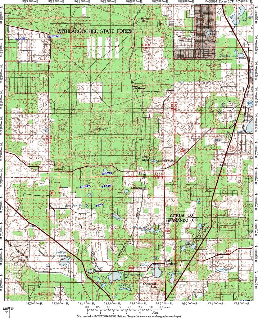
Jim Hartnett, the Race Director pulled all the teams out of the transition area at 7:20 AM for the start of the race. He had explained we would need to carry everything we needed for the first leg of the race with us, as there would be no returning to the transition area once the race started. Since the first leg involved paddling, I roped my kayak paddle to my back with my hip bag and gear – and our team got on a bus that was waiting to transport teams to the actual race start. We had still received no map and the only instructions we had were to prepare for 3-5 hours of running and paddling until we would see the TA again. The morning was cool with a nice breeze, so heat at this point of the race was not a factor. The bus took us a few miles north and dropped us off, as we exited the bus we were handed maps and passports. Jim had put all the “A” teams on the first bus – the idea was to keep the highly competitive teams together. The teams were standing around waiting for instructions while the bus left and we realized the race had actually started. I quickly determined our location on the map (it was not marked and we were not told where we were) and headed for the first CP. The other teams quickly joined and, some with faster runners and the race was on.

The first eight checkpoints had us covering about 3 miles of rolling hills at a good pace. All the competitive teams stayed closely grouped and kept the pace brisk. The navigation was not tremendously challenging and since the teams were all together there was a lot of bird-dogging. At CP8, the front teams headed west into a heavily wooded section, I instead called our team to head north. Four or five teams followed me on this route. My plan was to bushwhack through a short thick section and then to handrail between the woods (west) and the field (east). This worked perfectly and we soon hit our backstop, the powerlines, which handrailed us right to CP9 and the boats. As we headed for the boats we saw Don and Blaine (who had used the western route) carrying their boats to the was the river. We saw no other teams, though we knew a few had gone that route – we also knew that Don and Blaine would be leading the pack. We rigged our canoe for the portage and headed back east (short portage) and put into the river. We now had a small group of 4 teams with us and Don and Blaine leading on the river.

This next paddle section was probably best termed a hike a boat. The Florida hurricanes had left a tremendous number of snags in the river for the next 4 miles. We were also paddling against a strong current. Jamie and I with many races under our belts were adept at hopping in and out of the boat and pushing, pulling it over the numerous snags. Jeff had less experience at this hopping in and out of the boat (believe it or not we actually practice this) but with a little coaching quickly caught on to the rhythm. The current was strong enough that on one hop out I ended up in deep water and could not make headway against it, and instead had to swim to shore and run along the shoreline to catch my boat. We caught up to one more team, Sponsor Name Here, that had done a great job in the navigation from CP8 to CP9 and had held an unknown lead on us. We were however strong paddlers and we started to pull away from the field with only Don and Blaine ahead of us and Team Bill Jacksons (a 3 person male team) paddling close to us. We continued to leapfrog with Team Bill Jacksons to CP10 where we had to turn around, and then at CP11 where we had to climb a hanging ladder from the water and return to our boats. As we reached the take-out, now heading downstream our group of 4 teams with 2 more teams close behind remained intact. We pulled the boats out of the water, portaged to a small lake and once again began paddling to get CP12 which was on a small island in the lake. We paddled to the shore and began the longer portage to CP13 where we would drop our boats and start running for Main Transition Area. It looked like the 3-5 hour estimate would be a little ambitious as the lead teams were now at 4 ½ into the race and still a short distance out of the TA.

Though we did not realize it at the time, our team along with many of the front teams were not getting enough fluids, setting us up for serious dehydration later in the race. This is a danger of an early paddling section as you are not feeling hot (because you are wet) and do not remember to drink. I had only drunk 20 ounces this entire leg (one water bottle), I had lost the other water bottle at the start of the paddle. If anyone finds a Nalgene bottle filled with HEED being swept through the Alafia River into the Gulf of Mexico filled with HEED it is mine.

The next leg would put us on our bikes for what looked like 20-30 miles of riding on sand roads. The temperature was near 80 degrees, though hot – it was not stifling. The first few CP’s on the bike were easy navigation, though a missed turn in my navigation had our team doing a short bushwhack to put us back on track. CP16 was mismarked on the maps (the flag was actually 400 feet from the mapped location, and that ended up having us set up a search pattern to locate the control. At this point Bill Jacksons and Sponsor Name Here caught up with our group, as we had transitioned at the last TA quickly and left them. Knowing that Sponsor Name Here was by far one of the strongest teams on the bikes in Florida, we knew we would have to rely on solid navigation to stay in the race. Sure enough they started to outpace us by CP17, and were completely out of sight at CP18. Meanwhile the solo race (as we would learn later) was heating up. Don Had built a strong lead on the navigation on the bike, but in his haste had not cleaned the water out of his map case. The pool of water had dissolved the bottom of his map and the location of CP24. He did the only thing he could, go back to CP23 and wait for the next team come through so he could bird-dog them to the control. At the same time we worked with Team Bill Jacksons to pick up the controls CP18-23. We briefly saw Team Sponsor Name Here at CP21, as it required you to drop your bikes and bushwhack through heavily overgrown Gypsum pilings (in an old phosphate mine) to a phosphate pit where the flag hung over the pit. They were returning to their bikes as we headed out to the flag. I estimated their lead now at 10-15 minutes and growing. Then between CP22 and CP23 I became separated from our team while I stopped to read the map, which in turn cost us a few more minutes. At that point I made a strategic decision to skip past CP24, and return to it after completing CP25-29. This looked like a solid navigation move as CP24 was a long out and back and the approach from CP29 was shorter. I stumbled in my navigation slightly at CP25 missing the fork, but again quickly caught the error and returned.

As we headed from CP25 to CP26 we saw the lead teams and both Don and Blaine heading back to CP27. The approach from the map made it look like taking a bearing from the southern road intersection was the best approach. The reality was much different, the area between the southern attack point appeared to be impassible vegetation (at least it would slow you down dramatically). The better attack point was along a ridge line, attacking (much further) from the east north of CP 26. It would be an out and back along the line to CP27. Two teams (us and Sponsor Name Here) and two soloists headed in to get this CP. It was apparent Blaine and Don were pushing each other hard in the solo race, they both blazed across the ridgeline at a good run. We were instead much more cautious on the treacherous ground and emerged from the woods with Sponsor Name here and headed out on the bikes. They were amazed that we had made up the ground on them, but I informed them we skipped CP24 and were still a bit back. CP28 was quite easy.

We arrived at CP29 just before Sponsors Name Here completed the two special tasks at the CP. This CP required each member of the teams to walk a 30 yard tightrope with a high guide wire, and then take 5 potatoes and hit three targets with them. Jamie and I made short work of the tightrope (climbing is our element), however Jeff, who visibly shaking, fell one time with a big thud, and then a second time. We would take the penalty on this test. The next test looked difficult. You could use a knife to cut your potato into smaller pieces, but once it was gone, if you had not hit the targets you got another penalty. Jamie pitches softball so had no trouble hitting the targets, though a few misses on the last one had me teasing her. I cut my potatoes into quarters and quickly dispatched all three targets with a little bit of trouble on the last one (5 throws). Inadvertently I had prepared well for this event by walking my kids to the bus stop where we would throw rocks at the speed limit sign from the bus stop while waiting for the bus. Jeff, unfortunately was shaken both from the exertion and from two hard falls on the climb, he just could not connect with the target. Another penalty. Both penalties required a short run to retrieve a “word” from a posted sign. Jeff did the runs while I accompanied him on one and Jamie on the other. We had lost about 30 minutes here – but had seen no other teams. The race now had 3 teams and 3 solo competitors, but Team Sponsor Name Here had built a solid lead on us.

We still had to get CP24, and though the strategy looked solid from the map, the reality was worse. The roads shown on the map were now completely overgrown and our bikes soon became a hindrance. I decided we would drop our bikes and bushwhack to the control. This would only be about 400 yards of bushwhack – but through a heavily forested region, s short swamp, and wiregrass. Luckily my navigation sense was dead-on (probably from the difficult navigation at the Save the World race the previous week) and we bulls-eyed the control. It was too thick to run, but we bushwhacked back to our bikes and were now on our way to the transition area. We had run out of water over an hour previous, and I had given the last of my water to Don at CP27 as he looked to be in worse condition than I was. I was seriously dehydrated and a bit demoralized knowing that Team Sponsor Name Here had to have now built an hour on us. In the end the bike ride was well over 5 hours. We had an orienteering leg remaining, and then one more bile leg. Though our transition was quick, I was severely dehydrated at this point and my legs were not letting me run. We would have to walk at a pace just under what would trigger a cramp from my muscles. My team agreed with this and we fueled off we went. As we left on the final orienteering trek my watch read 9 hours race time. Team Sponsor Name Here, Blaine, and Don were all in the TA having completed the orienteering and heading out on the last bike. We heard the Team Bill Jacksons had just left on the trek, and one other soloist and that the next team behind us was “way” back.

The navigation on this trek was not difficult, we completed in the order CP31, 33, 32, 34, and 35 – though had I been fresh (and thinking well) I would have done 35, 34, 31, 33, 32 and then returned to the TA. We now had plenty of fluids (we would not make the mistake of running out again). The dehydration level and having not eaten enough had the entire team at a low energy level, though I was now the limiting factor, Jamie was still strong, and Jeff was recovering. Running the trek would have taken about an hour – but it was not until the last mile when I mustered enough energy to break into a trot. As we approached CP36 (the main TA) I heard Shawn Deitrich’s (of Team Bill Jacksons) voice from the MTA joking around. Normally hearing the other team in the finish line ahead of you is bad, but it told me that they either had not gone out on the last bike leg yet, or missed the cutoff. It was now 11 hours race time, and I was not looking forward to getting back on the bikes for single track riding in my current state. Our team would, of course, do what needed to be done. Sure enough they had missed the cutoff, and so would we – our race was now over after 11 hours and about 15 minutes (I forgot to stop my watch at the finish so this is a little bit longer than our actual finish).

Blaine Reeves had come of the trek with Don Nettlow, but he outpaced him on the last bike ride. Blaine, Don, and Sponsor Name Here had been the only teams to complete the entire course. We had finished shortly after the second place team (Bill Jacksons) who had missed the cutoff for the last ride, third overall team, and second coed team. I drank about a gallon of Gatorade and water as I sat and cheered the teams in as other teams completed the course. The format of the course had made it very challenging on all the team, with the early trek and paddle leading many teams to underestimate the hydration needs. The navigation was not terribly challenging to the top teams (none of the points gave the top teams too much trouble, and we all employed some strategy), but talking to some of the other teams – they had found it quite challenging.

In the end we took home the 2nd place coed trophy. The Talon continues to improve every year challenging the top Florida teams and providing a high level of competition. And we will be back to in turn challenge the Talon.

Talon Race 2004

The Talon 2004

The Talon is a 8-12 hour race held in Alafia River State park. The 12 hour race format is probably the most brutal – though you do not have the sleep deprivation issues of longer races, the intensity level is the same as the shorter sprint races, though you have to keep that intensity 2-3 times longer to do well. Team CFAR this time was Ron Eaglin, Jamie Sheriff, and David Brault (the three person coed was the competition division and that is where we wanted to race). A lot of very strong biker-based teams were at the race and the atmosphere was great (a lot of camaraderie).

The race started with a 3 mile double track bike leg that would lead us into the single track riding. The double track would give the bikers time to spread out and allow the stronger teams to enter the single track ahead of the slower teams. The course was very well-marked with large signs and was easy to follow until we approached the entrance to the single track – and there was nothing. The top lead teams (very well-seasoned, familiar with the park, and much better bikers than me) made the correct turn into the single track, however the second pack missed the turn and about a mile later found ourselves on the main paved road leading to the TA. This was wrong – I decided we would bike back to the TA for instruction and to let them know a turn was probably not marked. As we approached the TA, Jamie had a flat tire – so Dave and Jamie started changing the flat, while I informed the race director of the missing markers. I got Dave and Jamie who were just finishing the tire repair and we headed to the single track entrance – the race director had shown me a faster way to it than doubling back on our track. All the other teams that had missed the turn, had already doubled back and would likely beat us to the entrance.

When we reached the entrance it was now VERY well marked and we entered the single track pretty much in last place ( with a few straggler teams). Passing in single track is difficult (“single” track) and we were entering some very challenging bike terrain, the course called “Roller Coaster”. Many of the back teams were walking their bikes up and down the roller coaster like hills, and when we approached were courteous and let us ride through. “Riders Up!”, and “Riders through!” were being shouted throughout the trails. The pack was completely mixed with advanced riders and beginner riders all together. The call that I did not want to hear; “Slowing!” and “Stopping !” – were all too frequently being called as riders exercised caution based on their skill level on the challenging terrain. By the time we exited Roller Coast and entered the next single track segment “Pine Wood” we had passed about 7 teams – but were still moving much slower than we wanted.

Each trail at Alafia has a different challenge, Pine Woods challenge is the proximity and denseness of the tree forest. You simply have to get you bike between trees that offer about 6 inches clearance (on both sides), over and over again – but the ground is flat and not terribly bumpy. This is one of my favorite trail (probably because I ride a hard-tail and like the smooth ground). Passing was near to impossible, and it was not until we got into the last two trails; Rock Garden and River Loop that we were able to move at a comfortable pace. Comfortable is a relative word here, though – my triceps were burning and my back was hurting – 17 miles of single track can do that to you.

When we hit the TA we did the first special test; changing 2 car tires ! and bypassed the other 2 as they were crowded and started the 1+ mile run to the canoes. We arrived at the canoes quickly (with 3 other teams), rigged the portage and headed for the river (about ¼ mile down a trail). The disaster struck – I was not paying attention and as 2 teams ht the river and turned left, we blindly followed.

Here is a good question; if a river runs generally north and south, and you want to head south, and you are approaching from the west – which direction should you go when you hit the river ? Right or left ? Regardless of bearing – you should have answered correctly as right – well we did not. And we also did not realize this simple mistake until after about 25 minutes of grueling paddling, stopping every 100 yards to portage over trees. This is adventure racing – never give up. A team of good friend – whom we had raced against many times “Jim’s Bicycles” (I’ll abbreviate as JB from here on out) and we turned around and headed the other way. We had entered the water mid-pack and at this point we were assuredly way in the back (again!). Some other teams behind us (and at least one that had been in front of us, had made the same mistake), I even had a hard time convincing teams that they were wrong – but the right turn/left turn logic prevailed. I think the thought of paddling back through all the snags was not too pleasant to them.

Eventually we reached the a bridge that was CP9 where we had to climb a hanging ladder (and wait in line behind many other teams to do so) and we started a paddle loop to CP 10 and back. CP 9 was also CP 11 and I was able to determine that 5 teams had left the paddle and started the next leg of the race (orienteering), and there were many teams coming into CP 11. We quickly made our way up the ladder and then back around and onto the 2 ½ mile (approximately) paddle loop. This section was all open water and we were able to make CP 10 in 20 minutes, we turned around and headed back to CP9/11. Because we could see the front 3PC teams leaving the water as we were at 9, I determined they had a 45 minute lead – which meant that at least the teams I saw could still be caught. I had paddled all from CP9, CP10 and CP 11 and was leaving the water a little tired. A couple of teams had waited at the water for us to exit – wanting to navigate with our team, so we had a small group as we headed out into the orienteering.

The first control (CP 12) was misplaced (slightly) being a bit west of the mapped location, but visible from the true spot. We saw teams coming from different directions that also made it easier (based on their locations) to know where the flag wasn’t. (You do this in AR). CP 13 was very easy to find, as we headed for CP13 we saw many teams back-tracking to find 12 – I gave them some quick pointers and we moved on. Jamie was feeling very strong at this point – but I was definitely hurting (the paddle had taken a lot of steam out of me). Controls 14 – 18 would all be difficult navigation, so I moved us to a fast walking pace and concentrated on the map. We easily found 14 as the peninsula was distinct and arrived at the same time as Team JB. We backtracked around the peninsula, while JB cut across the water – that gave them a slight lead going into CP 15. CP 15 also had a distinct lake feature and the control was quickly spotted by the now pack of about 4 teams working together. CP 16 appeared to be the most challenging of the control, and indeed it was. We had been traveling in chest high grass since CP 13, and now the grass was thicker with other low brush. AS we approached 16 I made a strategic decision to punch through the canopied area to 17 and return to 16 and use it as an attack point to CP 18 (we could do the controls in any order). After emerging from the heavy vegetation boundary running E-W, we could see the PVC pipes marked on the map and quickly found CP 17, we then re-crossed the boundary and found CP 16. The trek from CP 16 to CP 18 looked like it was going to be a lot of tall grass (heading NW along the vegetation boundary) – but it ended up opening up nicely and we made very good progress as we rounded the corner of the boundary. The next part would be tricky keeping a bearing in very thick vegetation with no features – but we were due west of the control and knew we’d reach it on a westward heading. Sure enough we did and passed quite a few teams on the way. CP 18 to the TA was easy. We were the first 3PC team to arrive, though the top 2PM and 3PM teams had finished – we were where we wanted to be in our category.

We quickly went after the 2 special tests. I completed a 3D block jigsaw puzzle rapidly and joined my team-mates who had restocked fluids and were starting on a 3 page I-Spy challenge. My 2 daughters, whom I play I-Spy with all the time came and joined us, together we found all 15 or so I-Spy items on the laminated cards that had them. These were a couple of tough mental challenges when you are as tired as we were, but gave us some needed physical rest. As we were completing the challenges, one 3PC team had come and left, and Team JB came in – we left just in front of them on the last bike leg, a 8-10 mile bike on double track sand roads that had taken the top teams a little under 2 hours.

As we rounded the corner and headed for CP 20 it was obvious that Dave and I were both not doing well. In the grass on the O section, something had bitten me on the knee and I was feeling the poison in my system (today I feel fine – but have a couple of fang marks on my knee and it is really tender). As we crossed the water heading to CP 20 we passed the other 3PC team which were looking rough. We easily found CP20. Jamie was still very strong so I hooked up the tow and let her tow me (I still pedal – it just gives you an extra boost) to CP 21. We arrived there as 3 teams were trying to solve the puzzle. Jamie called off the clues and I immediately knew the answer. [Snake Eyes, Number of Pawns on a Chessboard, Number of Moons of Mercury ] which was the bearing to the actual location of the punch. We punched it with the other teams and headed for CP 22 – I was still under tow, but feeling better. We needed to make a left turn on the route and as we approached the road – it was gated. I hollered that we needed to take it. Team JB was now in front of us, but had missed the turn. Jamie stopped and made sure I was making the correct decision (I was still a bit delirious) – but we confirmed and headed south quickly reaching CP 22 and the next clue.

This clue was very difficult, it was a math problem with about 20 terms, we knew it would give the correct bearing – but solving it was hard. Jamie realized that my cell-phone had a calculator on it, but when I pulled it out of my dry bag it had gotten damp. Nokia phones tolerate just about anything but moisture – thus my phone simply hissed and blinked random words at me. Another team arrived as we were working on this and we got their cell and Jamie, Dave, and the now 3 teams worked through the problem. Meanwhile I took a different approach and organized a search group (basically told the folks waiting let look for it !). After climbing a hill to the NW of the clue, I spotted the flag and saw one searcher heading for it. I motioned for him and the other teams to the location. Meanwhile Team JB had arrived coming from the NW road and saw me pointing to the flag. Unfortunately I was not getting Jamie and Dave’s attention as they were still working on the math problem (which I now realized had an answer of 0 as the flag was due north of their location. I ran back down and we got the punch and headed out. We needed to head back to the main TA from CP 22 which was about 3 miles. Still slightly delirious I saw some teams starting south, but watching me. I mounted the bike and started NW up the hill. Team JB had gotten a jump on the bike and had a 2 minute lead leaving CP 22. It was now a two team race for first place in the 3PC division. Jamie urged us on (she was still riding strong) – I no longer needed the tow and was actually leading the team. I had memorized the map for the return trip and knew what we needed to do. Unfortunately, now Dave was hurting (quite a bit). I could see JB ahead of us and also Dave fading back, Jamie went back to put Dave on the tow, but the terrain was too choppy to effectively tow until we got to Thatcher Road. We made a right turn and over another fence and it was pure pedaling now. Team JB had increased their lead – and Dave was really hurting now. I knew we had no chance of catching them (but we also did not know if they had completed the mental tests). We rode in strong – with Dave under tow, just a few minutes behind them.

After a little cooling off and a Mountain Dew – we sat and chatted after the race. It was a big victory for them, and we also felt good that we had come from a near dead last half-way into the race to take second in our division. We had worked together to do this, and friendly competition is what this is all about. In its second year the Talon has established itself as one of the best 12 hour races in Florida.