Monday, February 18, 2013

Pangea Sea to Sea Adventure Race

Recently I've read a lot about "extreme racing" in the news. When it comes to extreme racing in Florida nothing comes close to the Florida Sea to Sea. This race, previously called Coast to Coast has been most recently operated by Pangea Adventure Racing who has maintained it as the great challenge that it was meant to be. Here is a point by point description of the race that I ran this year with Team Honey Stinger - Erik Wise, Junos Reed, and Julie Ardoin. I would also be starting the race with a cold - which unfortunately had me hacking and coughing in the hotel room the night before the race keeping not just me but entire team awake most of the night.


Part 1 - Pre-Race

The race typically meets on one coast, buses the racers to the other and then we simply race back to our cars - pretty great. It is unsupported, each racer gets a gear bin, and the team gets one paddle bag and one bike bag which we can use to transport gear for those sections. We started at the Best Western in Crystal River and were bused to JB's fish camp in New Smyrna Beach where we would begin this great adventure.


Leg 1 - Paddle Across Mosquito Lagoon

After a short beach run all the teams hopped into canoes for nice short paddle across the Mosquito Lagoon to Riverbreeze Park where we hop on our bikes for the first real section of the race. Our team took it very easy during this section, popping out of the water at Riverbreeze well towards the back of the pack.


Many teams completed this paddle in under one hour, our more leisurely pace was one hour 16 minutes


Leg 2 - Bike to Rock Springs  (CP3-CP4)

The next bike leg was a straight-forward bike using Maytown Road to Sanford and then from Sanford to Rock Springs run where we would end at the horse barn. We had 2 Checkpoints along the way - one on Maytown Road at Deep Creek, the other at the entrance of the Central Florida Zoo. Our team went north around Lake Monroe on the Spring to Spring trail rather than taking the slightly shorter but more traffic intensive southern route through Sanford. I was happy to see my wife, Linda, was able to greet me at the Zoo checkpoint, but all I had time for was a kiss and hug.

As we left the zoo it started to rain. It would eventually start raining hard and the rain would continue all night long (through the orienteering and the paddle).

We were pretty fast on this leg 3:12, times ranged from 2:40 to nearly 4 hours.

Leg 3 - Rock Springs Orienteering (CP5-CP14)


Video Here Here we are at the start of the Rock Springs Run Orienteering section. Notice it is raining pretty steady.

I was looking forward to this orienteering run, and it did not disappoint me. Even though I did not find and of the checkpoints terribly challenging, it was setting the stage for more challenges later on in the race.Each point had its own special challenge - we did the course in essentially reverse order (CP14 first - CP5 last) - this made CP5 more challenging, but made CP8 much easier. We "fast" walked the entire section and finished in 2:45. Times on this ranged from 1:58 to much longer (some teams skipping checkpoints).

Some of the trekking we had along the Rock Springs Run Orienteering Section
Rock Springs Run Orienteering Map


Leg 4 - Bike to Margaritaville (6K no CP's)


From the end of this we biked to Margaritaville Camp near Katies Landing on the Wekiva River. It was dark and we almost missed it as I was heading to Katies Landing. This was a 6 km bike, the most challenging part was crossing SR46.

Leg 5 - Paddle on Wekiva River (CP15-CP19)

This leg was a make or break for competitive teams. It was dark and the checkpoints were quite challenging.

The first challenge was CP15. We passed Endeavor AR on the way to this - so we both headed into the little channel to find this together. As we searched we ran into 2 other teams - including Florida Xtreme/Grammicci. None of the teams were having much success in finding this. I decided to get out of the boats and confirm our position by using a known location - in this case it was an unnamed street (driveway) that was mapped. Even after this - it was very challenging to get to the spot to beach our boats and then we would need to shoot a bearing and find the control. We came up on the small inlet (clogged) and the bend (subtle) - and I did find a small ditch (water drainage) that was mapped. After that we found the control - and all the teams headed to the next challenge - CP16.

As we left CP15 and were paddling through the weed clogged channels we heard a big splash behind us. Nope - not a gator, Erik and Julie swamped their canoe. They were cold and dry, now they were cold and wet and gathering all the gear floating in the river. The river was about 3 feet deep where they swamped so we put all the gear in the boat Junos and I were in and started to get the water out of the swamped boat. The river was narrow - so the T maneuver that we had to do was challenging, however we did it, righted the boat, and started moving again. Good thing Erik an Julie are tough, because now they were wet(ter) than they were before.

CP16 was what I call a bingo, there was no real distinct feature on the river to tell us where to stop, and the control was a good ways from the rivers edge requiring some real navigation. We had 3 teams traveling together - but FLX/Grammici peeled off before the location where I was pretty sure was correct. When I got the spot where I wanted to start - I did notice there were footprints in the woods. The bearing on the control sheet did not take us to a flag, but following the footprints led me right to it. Whoever was there before us (as it turns out REV3, CP0, and USAF) had made my navigation much easier.

CP17 was a nice long paddle down the Little Wekiva River. We paddled for about 40 minutes (with Endeavor) and I was pretty sure we had passed the control location. We turned around and sure enough found the split in the river that was the distinct attack point and could see the river branch totally obscured by logs. We got out and shot the bearing and even with 8 of us walking the woods, we were not having any success. We had also not seen Grammici since before CP16. As we were searching Team Oddysey showed up. I was about ready to hang this one up - but I decided to give a little more time, and with Odyssey we found it in about 5 minutes in a spot where we had already looked. Junos and I led the convoy of team (7 boats) back out of the river and we headed for CP18.

We never found CP18 - but it was not for lack of looking. The mapped river showed a few islands making side channels - but the reality was there were quite a few more. The 3 teams (Endeavor, Odyssey, and us) searched. After about an hour we knew we needed to give up to make the time cutoff that was coming at the next TA. This also required us to skip CP19 - which was not sad since it looked to be about a 3 hour paddle up and back on the Rock Springs Run (and also a very challenging spot to find). Odyssey stayed and did eventually find CP18 (and got CP19 too).

CP15 - Along the Wekiva

CP16 - A bit more challenging

The long paddle down the little Wekiva to CP17

CP18 and the finish to Wekiva Springs State Park


This took us 7:07 and we still left 2 controls behind. This was the same time it took REV3 and they got all the controls. Odyssey did stick it out and spent 11:13. Florida Xtreme/Grammici skipped both CP16 and CP17 - but they found CP18 and also went all the way upstream for CP19 which finished them with 3 controls after 9:10. Endeavor spent a lot of time and finished in 8:20.

Leg 6 Wekiva Springs Orienteering (CP20 - CP29)

After a short but painful portage to bring the boats up to the parking area and off the springs we received the next maps. It felt great to get out the boat and once again I was on my strength - land navigation. We simply nailed every single one of these controls doing them in order. It was dark (I practice night navigation) but we had good lights and we took a very conservative approach - finding good attack points and shooting bearings. We got all the checkpoints and finished in 4:21. We had a 8 AM cutoff for finishing this section and we finished nearly an hour before this deadline. If anyone wants to know how I approached this (I lost this map) use the comments - I'll be happy to let you know how I did this. REV3, CP0, and USAF were the only teams to make the cutoff with all the checkpoints.

Sorry - no map for this one (cannot find it).

Leg 7 - Bike from Wekiva Springs to Lake Louisa (CP30-CP33)

This was an easy leg which had us biking down the West Orange Trail and the Minneola Trail to Clermont. We took it pretty easy and even stopped at a little quick mart for sandwiches (I had a Cuban) which really perked us up. Just after the sandwich break, we went to retrieve a control at the end of the dock at Lake Palatlakaha. We sent Erik down the dock ahead of us where he slipped, fell, and broke his hand. Well maybe - but it was very swollen and hurting him for the remainder of the bike ride.

We finished this in a respectable 4:30 (even with the 30 minute lunch break) and pulled into the parking lot at Lake Louisa around noon.

Leg 8 - Lake Louisa State Park Orienteering (CP34-CP43)

At Lake Louisa the team was feeling good and we were also pretty psyched as we were now in the top 5 teams. This was also going out to the internet bulletin board where we had lots of folks watching the race. Junos (later) heard from his wife that there were friends over watching the race progress and the room erupted as we updated to 5 place on the web site.

For us back at Lake Louisa I was preparing to push this one and make some real time. We again moved very quickly and efficiently through each control. Go to attack point, shoot bearing, punch control. This was working well.

A view of the wide open terrain at Lake Louisa State Park.


At the Lake Louisa Transition with the other teams.
Junos coming out of a Sinkhole in Lake Louisa.


We did have to stop for foot repair (blisters), and I had one toe that was oozing blood (no blister though) - but this was not slowing us down too much. The next leg was a long bike that would give my feet a chance to heal. I also could see Erik's foot wound hurting (he has pins in his foot), and Junos had some serious hot spots and was questioning Julie about popping them. Julie said yes and he cleaned his blisters - and Julie covered them in Leuko tape. I wondered if my route choice between CP35 and C36 (which involved a stream crossing) might come back to haunt us later (wet feet).

We still finished up the leg in 4:19 (which was the 4th fastest time). We did this with walking only, and with a 15 minute rest/foot repair break. I was also able to get some food in me. Once we completed the leg - we were also told we were now in 4th place, which got us extremely motivated.

Navigation Side Note  - In most races I race I do the navigation. Teams that race together a lot and have a great team dynamic "protect" their navigator. While other team members can easily pull food from a pack, grab water, etc... the navigator is always focused on the map and typically has extra pieces of gear (map/compass/case) that they have to carry in their hands. Teams with a good dynamic realize this and make sure the navigator both remembers to eat - but they also get the food for them. This was going on at this stage and it was making a difference. I had been eating well - and feeling strong. Eating had made a difference, but having the team make sure I was eating well was what was allowing this to happen.
 

Lake Louisa State Park Orienteering Map
 

Leg 9 - Bike to Withlacoochee TA (CP44-CP49)

In adventure racing - just when things are going well, disaster can strike. We were fresh from the news of our position, we had a good transition, our lights were mounted and we were heading out on bikes. Not 200 yards out of the TA we hear a scream behind us and Julie is on the ground with her bike on top of her. We got her unclipped and onto her back, she is nauseous, scraped badly, and obviously hurt badly. I went back to the TA - got some help - and we had to make the decision that all teams dread. Julie had received a concussion in the fall and was hurt badly - we had to leave her behind.She wanted to get up and try to bike, but the nausea and her team-mates kept her down.

We would not find out more news on Julie until much later. It was getting dark and we were heading into Richloam Wilderness Area. Our motivation level was low, but we did want to get some controls on this leg. We headed for CP44, and found a few teams there. After finding it I did something I wanted to do - hollered "here it is" and had all the other teams moving in on it. We headed south to the Van Fleet trailhead that we came in on (at a Waypoint) and headed west into the forest. Within about 10 minutes we were surrounded by multiple trucks with hounds in the back. After some friendly banter with the locals we had a good idea of the best roads (limerock, not sandy) - and mostly of where they were going to be running raccoons with their dogs. Two of them even followed us to make sure we found the trail we were looking for (essentially we rode to Lead Pipe Road on Central Road). We picked up C45 - and then decided to head to the TA. We went via CP48, but did not see the trail heading in - so kept moving.

With the 2 controls - this section took us 5:37.

Leg 10 - Withlacoochee Trek (CP50 - CP60)

At the TA HQ at Withlacoochee, looking at trek map

As we were in the Withlacoochee TA we heard the news that it would be very cold on Saturday night (that and windy).We decided that we would want to head out on the River Saturday morning if possible. That would put us at the finish line Saturday evening which sounded like a great plan to me, finish, warm food, and a hotel bed to sleep in Saturday evening. I needed some rest before the trek, and more important some real food. There were hot Ramen noodles at the TA and that really helped me. I took a 20 minute nap in the tents, threw on my shoes - gathered the team - and we headed out.

A little taste of night trekking in the dark Richloam forest.

 The first control point (CP60) took us nearly an hour, simply because we took the bearing off the wrong bridge. After realizing this, we headed about another 150 meters to the correct bridge and found it quickly. The others were pretty uneventful - even though they were challenging. After a few hours Erik's foot had really begun to bother him too, so we decided to only get CP60, CP59, CP58, and then grab CP50 on the way back. Even with the shortened course we were out for 6:03. Teams that decided to do the entire trek were out for much longer (CP0 in 16:03, Endeavor in 11:06).

Endeavor had a really good strategy for this section. We had seen them in the TA before we headed out onto the trek leg. They had taken a solid sleep time for the team. As we were heading back into the TA from the trek - they were heading out - and were running (pretty well in fact). They cleared this section in the fastest time.

Trek map for long Withlacoochee trek


Leg 11 - Withlacoochee River Paddle (CP61-CP64)

Video Here
The three of us in the boat on the Withlacoochee River just North of Dade City.


This would be a long paddle, and even though the length does kind of wear you down, the nice weather and good company made this enjoyable. We were able to take some turns resting in the middle of the boat for parts of the paddle. Also good news is that Erik's hand ad healed enough for him to paddle.

The team leaving the Withlacoochee TA

The paddle took us 7:22 which was a pretty respectable time.

Leg 12 - Bike to Finish Line (CP65-CP66)

As we got to Nobleton, Junos got to rescue a canoe on the far side of the river that had blown away from the kids at a house on the far side and was heading downriver in the wind. Julie was waiting for us at the TA - it was good to see her feeling better, though she was still recovering from the concussion.

It would be nice to say we had an easy 65 km ride to the finish, but that is not what happened. We were doing our best to hold it together. The first CP was pretty easy (go to the entrance for Floral City and get the date of founding, 1883). Coming back from this Junos was starting to lose it and was determined that we skip the next CP - which was no big deal. The next CP was in a cave that I had spent hours searching for in a previous race - and I had no desire to go back, but was also convinced I could find it again pretty easily. We headed west. I had not looked at the maps prior to this other than to look at the coordinates of the start and the coordinates of the finish. This allowed me to estimate it was at least 55 km. I do this by simply using the difference in the Easting UTM plus the difference in the Northing UTM coordinates between the start and finish of the leg. This is normally amazingly accurate in estimating a total biking distance.  

After some punishing riding against a strong headwind and up and down amazingly large Florida hills we were starting to have some issues. I had a spare 5 hour energy (Walmart brand) and that helped perk Junos up. Erik had been pulling us the entire way and just wanted to get to the end. He was talking about hitching a ride with some rednecks. We stopped along Lecanto Highway about 3 miles south of SR44 and regathered the team. We knew we had about 8 miles of headwind - but we could do it. As we got closer the wind got harder, but our spirits got higher - and as always we crossed the finish line 3 hours and 53 minutes after we started the bike ride.

Total time 57 hours 39 minutes.

Finish line photo


All stats and information for the different legs is at http://www.pangeaadventureracing.com/event-details/events/2013-sea-2-sea-ar 

After the Race

It was Saturday Night, we were incredibly tired and hungry, there were no rooms at the end hotel, and Drew (Greg's Son) had my truck. Luckily I was able to call Julie who sent her husband Joe to pick us up and we found a room at a nearby hotel. Some great food, and a good night sleep and we were doing much better. We were even talking about the next race... 


Sunday, January 20, 2013

Resolution Adventure Race 2013

It's time for a new adventure racing season and we love to start the races off with the resolution. First it is an 8 hour race which is a good distance to start the season, long enough to really test the teams and without the insanity of speed that you have it shorter distances. Lake Louisa is a great venue - and finally Manny Otero produces a great design that combines the best mixture of challenging terrain and navigation.

We planned to have to 3 person teams racing together; Florida Xtreme/Honey Stinger (Ron Eaglin, Jim Gorton, and Wanda Timmons) and Florida Xtreme/Darn Tough (Junos Read, Melissa Watson, and Chris Xiste). This is itself provides a logistics challenge as you have to keep 6 people healthy and on the same pace. On the other side having 2 sets of maps and eyes on what you are doing. Melissa and I have worked as a team at multiple national championships and it was great to be able to race with her again. The race started with 2 short prologs - first a 3 checkpoint run.


Run 1

We moved through this run very quicky. The real challenge was getting to CP1 which required a swamp crossing. The route from the map would be to find Waypoint 1 and take a bearing from the Waypoint. This might have been a good route - though I do not know, we opted to go south through the light green area on the map. Unfortunately this was still extremely thick and as we approached CP1 from the south I could see Good'Nuff and air force leaving the control with already a 3-4 minute lead. The rest of this run was uneventful and we cam in at 35 minutes which was a full 8 minute behind Endeavor who flew through this at 27 minutes.

 Bike 1

We hopped onto the bikes and were off to get complete CP4 - CP7. We had passed CP4 on the run and had no trouble nailing it quickly. The only one that was any trouble was CP7 simply because I wanted to attack from the west instead of the obvious attack from the south - though we correct quickly and did not lose much time.Florida Xtreme/USAF was the fastest on this section at 34 minutes (we were 42 minutes).

 Paddle

The  paddle was what defined the race for most of the teams. We arrived at the paddle TA and got the instructions and the bearing to the first control. Once we had the control number at that point it allowed us to look up a bearing and distance to the next control. We started bad - At the first control (which was correct) we headed to the wrong CP which in turn took us across the lake to CP53 which told us to go to the finish. We knew this was unlikely - but paddled back across the lake to the main TA where we were told that all the CP's would have to be done before we finished. We also noticed that there was a CP very close to the main dock. Manny had suggested that we plot the controls using the bearing and distance - so I made a quick scale and using my compass plotted the 2 points I knew the bearings and distance for.

Using the bearing and more important the distance I determined that the CP near the dock was the correct CP2 and we headed to it and got the bearing and distance to CP3. This was a challenging one - I plotted it and we did head directly to it, however I could see a second CP on the same bearing a bit further on. The first was CP61, the second was 87. We were pretty sure 61 was correct, but my scale marker had the CP about halfway between the intersection of the line and the shoreline for each control. We paddled to the other CP and read the bearing and distance and determined that it would take us to 70 that we had visited and knew would lead us to the final CP, we paddled back to 61, took the bearing - I mapped it and it took us to 34. From that point all the controls and bearings made sense and I was able to plot them all to ensure we were doing this correctly. One challenge is trying to plot a bearing AND a distance (yes I measured distance too) on a bouncing boat. Once we finished we had Manny check our cards and we knew we had done the paddle correctly. We also learned that only one other team had done it correctly - but we did not know what team that was (we thought it was FLX/USAF). We exited the water shortly after CP Bound.

In the end we spent 1:58 on the paddle. Good'Nuff - 1:25, CP Bound 1:50, FLX/USAF 1:40, Endeavor 2:15. Here is my marked map from the paddle.


Trek 2

We headed south on the road for this trek. Basically it was long. The navigation was easy and the terrain was both bad and good. Bad stretches of Caesar Weed, tall grass, and deep sand were mixed with sections of packed trail and open woods. We were behind CP Bound for the majority of this and were able to stay close to them up to CP24. Around CP24 (heading to CP26)  Jim pulled a muscle and we were slowed to a walk and also survival mode. The plan was to get Jim to the bikes where we would be able to at least tow him through the bike course. If you look at the times for all the teams for this trek you will find that except for FLX/USAF (1:49) we were inside of 10 minutes of each other - with Good'Nuff (1:59) and FLX/USAF (1:49) being fast and the rest being a bit slower. We were 2:09 which I considered pretty good considering we had to walk the last 2 miles.

Bike 2

Back at the TA as we were transitioning we also learned that CP Bound was the team that had done the paddle correctly and we were in 2nd. They were roughly 10 minutes ahead of us out of the TA. At the same time we had one racer on a tow (Chris would be towing Jim) and Wanda was feeling a bit weak on the bike. I chose to do a northern loop CP32, 31, 33, 34, 35, 36, and 37 and then a southern loop CP27, 28, 29, 30. One reason there was better terrain in the northern section and more controls. I knew that we would likely have to skip some controls and the controls to the south were much easier to bail, especially CP28 which was a long sandy out and back. This strategy proved very effective - CP Bound headed south and used up a lot of time on those 4 controls.

After leaving CP27 and pushing bikes down the long sandy road south - skipping CP28 was an easy decision. Most of the ride from the intersection south of the small lake to CP29 was grassy and relatively easy riding. Had we had 5 more minutes we could have gotten CP30, but I had to skip it on the side of caution. Chris was towing Jim, Melissa was towing Wanda and Junos and I were navigation and punching.

In the end we got all but those 2 controls and 1st and 2nd place - though we would not know this until they got done scoring. Junos and I felt great through the entire race which is important as we had been training really hard for the Sea to Sea. Melissa and I fell right back into the rhythm we had as team-mates from all those years ago and decided we would race some 30 hour races (our favorite distance) together this year.

Manny had set a truly challenging course and we had come out and thrown ourselves against it hard - great day, great race! Also congratulations to CP Bound which earned a spot on the podium and likely would have been on top if they had chosen the northern loop on the bike leg.


 Florida XTreme/Darn Tough

Florida Xtreme/Honey Stinger

Florida Xtreme/USAF

Good 'Nuff

 Endeavor
CP Bound


Saturday, December 29, 2012

Bubba Goat Round 2


What could be better for a Saturday afternoon than a surprise Bubba Run. Yes - it was a return t Lake Louisa State Park for Bubba Round 2. Junos Reed and I headed out there to compete and have a great time. The plan was for us to run as a team and do some serious training for the Sea to Sea.


The Bubba (this time) was a 3 loop race. Each time through the transition area we got a brand new map, and would do another loop. Each loop was about 2 1/2 miles. After we headed out on the first loop Junos and I realized we had different map and after about 10 minutes of confusion we were back on track and heading different directions. From my track - we first started looking at our mistake at 6 1/2 minutes in, and were finally on the correct track at about 15 minutes (ouch!).


Back on track - I ran quickly through the 3 loops with minimal error and ended up placing 2nd behind Dash (Dave Ashley) who ran a great race with no real mistakes. Here is my track


Here are some pictures of the first Bubba

http://www.floridaorienteering.org/photos/gallery3/index.php/Bubba-Goat---Lake-Louisa---9-Dec-2012

Sunday, December 16, 2012

Chrismas in Christmas

I had the fun of doing the Christmas in Christmas Adventure Race in Tossohatchee Wildlife Management Area this Sunday. It is always a lot of fun to race with Erik and Jeanette as Team Mojitas on Monday. I wore my tracker during the race so you can see an bit of an embedded play of what we did. Here is a little narrative


http://www.flickr.com//photos/pangeaadventureracing/sets/72157632281724820/show/

(link to slideshow)

Bike 

 We drew the marble for the bike leg first. I originally did not want this - the last few races I have been the first through the trek and bike legs and have had my share of eating spiders. Sure enough this was the same for the first part of this race, first one through - plenty of spiders. We did however move very fast (45 minutes for leg - fastest of all teams) and later in the day the route got "chewed up" by bikes slowing it down. Nothing really to report - navigation was easy and we were dead on every control.


8
Trek

This was the leg where teams could really get lost. We went first to CP1 and then just went bearing and distance to all the other controls. From CP6 to CP4 brambles forced us a bit too far east - but I used the open area to the west to correct. We nearly completely blew CP5, Looking at the track below, we were heading nearly due south (way off our bearing). We came out at the open area that I was planning on using as a back-stop. I used the "shape" of the tree line to determine we were south of the control, and I corrected us north and back to the marsh where it was located. That was an 11 minute mistake - doh! On the way back north we completely missed the east-west road to CP3 and ended up running the yellow trail instead - no real time loss (maybe 1 minute). Straight trail jog back in and then to boats.

Paddle

The paddle was really a bike leg with a short paddle thrown in. As we headed out we realized Jeanette had forgotten her bike helmet - she was wearing a cap and it is a pretty easy mistake to make. We went back, got the helmet and restarted. The paddle was easy and uneventful and Jeanette navigated this section nicely.-The bike helmet cost us 5 more minutes .

22

In the end Jeanette felt bad about the time lost to the bike helmet - but my mistake on the bearing on CP5 cost us twice as much time as that did. We raced our race and we raced it well and finished well under 3 hours (2:55) for a podium finish.

Sunday, December 09, 2012

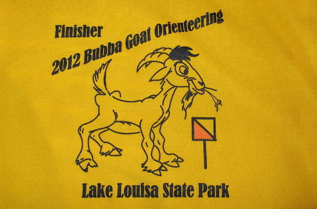
What is a Bubba Goat?

Florida Orienteering hosted a Bubba Goat race Dec. 9. Of course the FLO championships were Dec. 8 and due to family obligations I had to choose one or the other, of course I chose the Bubba.

Now - what is the Bubba Goat? Well it is an orienteering run, kind of like regular orienteering except ....

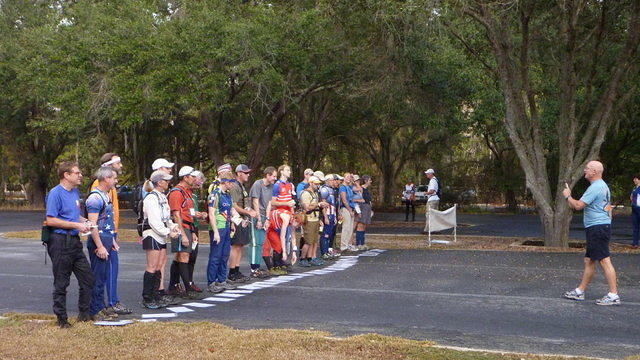
1. It has a mass start.
2. It has (slightly) different rules that ca be different for each event
3. It is really long (in this case 17K as the crow flies and we are not crows)

Now for most endurance road athletes - 17K is not really that far, but it is pretty far for a few reasons. You really don't go in a straight line making it more like 20-25K, you have to actually find the controls as in orienteering, and the terrain is brutal - in this case soft sand, high grass, Caesar Weed, and palmetto.

This Bubba Goat started with a 7 control prolog. All maps are placed on the ground, someone says go, everyone picks up their maps, and the you go. Racers were assigned a handicap based on age and sex - I had a one control handicap allowing me to only have to do 6 of 7 - though I did not use my handicap. Here is the map of the prolog (I did my route in pink);


After we got to the "Finish" it was actually the start of the long courses, an it was long. We ended up using a lot more trail as the rough open was really rough open. For example leaving CP3 and heading for CP4 we headed North to the trail to avoid the roughest terrain, though it did open up nicely in spots.


The off trail section from CP4 to CP5 was extremely difficult, Jim Gorton and I were running together through this section and Gareth Hearn who was with us near CP4 took the trail to the west and saved some time.

 Leaving CP5 was also pretty tough and this area is very open - we could see a few racers in front of us, an a few behind us. The uphill climb to the trail from CP5 was tough. The toughest part of this leg was actually the approach to CP7. M plan was to run the ridgeline off of the trail. As we left the trail - we entered the world of Caesar Weed. This stuff is aweful and particularly awful this time of year. The little sticky seeds coated pretty much every racer that wen through here - it was everywhere. When going through this stuff it is tempting to stop and pull it off. In a race this is not an option - plus we were covered!

We decided to skip CP8 (we were allowed to skip one CP) and head to CP9. This was most all trail, though it was very sandy trail. The length of this leg was about 2-2.5K, that is a long orienteering leg. Jim and I were running together at this point and running strong. Since we adventure race together for team Florida Xtreme 2 (and we had just won the Pangea premiere series in adventure racing) we were all about racing as a team.


This next set of CP's was quite a bit of fun. I especially liked CP11 to CP12 which allowed us to follow a thin strip of white woods (though some racers went around via trail) along the marsh. That was pretty cool. 


We kept the pace up to CP13, but after CP13 I started developing cramp in my toes, calf, and hamstrings - nothing like getting cramps everywhere! This reduced my pace to a fast walk (I do have a pretty fast - fast walk), even though Jim could have easily run the last few controls - he stuck with me. Our navigation was clean, if slow, all the way to the finish line - just below 3 hours (2 hours, 59 minutes, and some odd seconds).

 I was really hurting at the end, legs were cramping bad, stomach was upset. I took an ice cold shower (they had showers at the end - if you don't mind cold water) chatted a bit and headed home. (Jim had a 2-3 hour drive, I had just over 1 hour). My drive ended up being a bit longer as I had to stop and empty a barf bag I had the foresight to put on the seat next to me. That is 2 times puking at the end of 2 races! I must be pushing too hard. Of course afterwards you feel so much better.

Now after a nice hot bath (solves the cramping) and a Steak and Shake meal - I am planning the next race - Oh yea - next week! the Pangea Christmas in Christmas race with team Mojitas on Monday next week.

For pics and upcoming events - see http://www.floridaorienteering.org/

Sunday, November 25, 2012

Turkey Burn Adventure Race

1 - Florida Xtreme 2

The Turkey Burn is pretty much the annual state championship for adventure racing. This is the race that team Florida Xtreme 2 had been psyching for during the last few races of the season. We knew there would be some serious competition. Good 'Nuff, a team with excellent athletics, Primal Instinct with solid navigation and relentless forward movement. This race also has a 4 AM start meaning we would have about 3 hours of the race in the dark and 9 hours of the race in the light. This means navigating under both conditions. The other factor is cold. The start of the race is usually quite cold and quite warm towards the end of the race. Here is a blow by blow of the race as experienced by team FLX2 (Jim Gorton, Wanda Timmons, Erik Wise, Ron Eaglin).

 Bike 1

 The race would start with a bike leg through the trails of Seminole Ranch. There was only on CP in the first part of this section. Most of the bike team took off very quickly, we stayed near the back of the pack - allowing us to warm up as we continued to ride. The section had some treacherous holes and Jim took a couple of endo's while leading the bike line through this section. The first CP was pretty easy - though it was on the side of the trail I was not expecting (right, not left). The second CP was a simple out and back on the tower in Buck Lake, and the other four checkpoints were easy even in the darkness just be having good accurate measurements on the map ahead of time.

Bike 1
Good'Nuff: 1:53
FLX: 1:54
FLX2: 1:57

79

78

 Paddle/Trek

This took us to the start of the boat leg at the boat ramp as Six Mile Creek on SR46 and we arrived with Good'Nuff, Primal, FLX, all within a few minutes of each other. We headed north up the creek to CP7, where we took out of the boats for a short foot section.CP8 looked like an easy find - go west to trail and follow to CP - this was not the case - there were LOTS of trails and no clear distinction between them. All teams bailed back to the boats and we shot a bearing to find CP8. The rest of the course was easy navigation, though we did get to do an early morning swamp whack through a VERY wet section, there was another way around, but we did not take it.

Paddle/Trek 1
FLX2: 0:58
Primal 1:02
Good'Nuff 1:02
FLX: 1:01


19


23

 Paddle 2

We arrived back at the boats with FLX and Good'Nuff and headed south for the paddle leg. The first 2 points of this leg were easy, there was a little challenge finding the entrance to Shad Creek, and there was a lot of large grass islands - but we basically moved on the correct bearing and we got to the correct locations. After crossing the tower bridge on the south end of Loughman Lake - we had to CP's to find in a maze. I used a bearing to go for CP17 first. The clue was in grass on edge of channel (everything was grass and creeks). By using the bearing from the tower (which was visible from pretty much everywhere) I was able to make sure we were at least on a correct bearing and we quickly found CP17. I took a bearing from CP17 to the location of CP16 and we essentially boat-whacked our way through heavy weeds to CP16 (I also used the bearing to the tower to triangulate). We had gone into this section Good'Nuff and FLX - but as we came out we saw nobody behind us. When we reached the boat ramp at the TA - it was confirmed that we had a pretty solid lead on the teams behind us - and we started out on the second paddle.

Paddle 2
Primal: 1:50
FLX2: 2:05
FLX: 2:19
Good'Nuff: 2:37

Here is the start of the long paddle leg.

CP16 and CP17 shown here were the most challenging on this leg.

Paddle 3

This was through a maze of channels - but we had a good map, and we quickly completed this (I suspect this was probably the paddle leg of the sport race). A highly motivated Team Good'Nuff was working hard to erase our lead here.

 Paddle 3

Good'Nuff 0:53
FLX2: 0:57

This was a great map for the paddle 2 - we moved through it pretty quickly.

 Trek 2

 We took a long time transitioning to foot for the next leg, and as we headed out we saw FLX and Good'Nuff heading in from the second paddle - hot on our heels. We wen first for the cattle pen, and the 2 CP's to the east of Hatbill Road. We then headed back into Seminole Rance where we picked up 3 more an then headed out to the road (Unnnamed Street). There was no discernible trail south of CP20 (that we saw at least), we simply bushwhacked through open woods to the intersection of the trail heading south to WP21. The only CP to give us any trouble here was CP23 the one on the cut Cedar Tree - but only a few minutes. We saw a few other teams on this leg, inclduing Team Mojito's on Monday just starting into the trek. After getting all the CP's a short run back to the TA, and we were ready to head out on the bike/run/bike leg.

Trek 2
Good 'Nuff: 1:09
FLX2: 1:24

Order: CP24-CP25-CP26-CP18-CP19-CP20-CP21-CP22-CP23
Bike 2

We did not know at this time, but the race was shaping up to be a 2 team race. The next leg was a bike/run/bike leg. We were leaving with Good'Nuff right on our heels - and they are probably the strongest biking team in the Southeast. We hooked Wanda up on the tow and headed out. Good'Nuff passed us right at the water crossing, we got there first and were able to use the canoes to transport the bikes (but we swam) across the channel. Of course there was no way to get the boats back across as the ropes that were supposed to be used were not tied to anything on the shore - the boats were simply tied to each other.

We stayed pretty close with Good'Nuff until CP36, but we simply did not have the bike legs to stay with them. There were also a couple of bike death marches in the south section and also a third one approaching CP38 down newly "disked" Bear Bluff road which was completely un-rideable. I noted that Good'Nuff took a different route and had been able to avoid that final death march.After what seemed like forever we finally got to the Dairy TA and the final trek leg.

Good'Nuff 2:50
FLX2: 3:35

Even though one section of this bike was meant to be tough - Bear Bluff Road (.9K) and the route north to Dairy TA were really tough and sandy (essentially un-rideable while tired)

Trek 3

Once we started the trek leg we knew we were going to run out of time. The course had three bearing points - and I went ahead and plotted them on the map they gave us at the TA. This allowed us to bypass the long bushwhack on these and head straight for the actual CP - which for the first one happened to be on a trail (I actually mis-plotted it the first time, but replotted and we quickly found it). We also went for one quick on to the south of the TA and then hopped onto the bikes for the long ride back.

Bike 3 

On the final bike leg CP46 took us way too long, which meant we ended up having to bail on CP48 on the way back. We caught up with Good'Nuff who was also out of water at CP47 (I had an extra water bottle for them). On the way back we swam both crossings (which as it was getting cold - felt cold), and finished with 6 minutes to spare (in 1 hour 20 minutes).

Part of trek 3 - Since this was a bearing course, you can see my plotted actual locations of the CP's

In the end Good'Nuff cleared the course - which was no small feat. We came in second after putting it all on the course. Many thanks to Dave Brault for the incredibly punishing course, and Pangea for giving us a great challenge.

At least the first 9 hours of our course was caught by my tracker - it is at http://connect.garmin.com/activity/246861354

Final results are at http://www.pangeaadventureracing.com/event-details/events/2012-turkey-burn-ar

Some great pics at http://canyoneros-ar.blogspot.com/2012/11/pangea-turkey-burn-ar-elite-12hr.html


Saturday, October 27, 2012

Lighterknot Adventure Race

It took me a while to get this race report up, but here is a short write-up of a fantastic course. I was racing with my traditional Florida Xtreme 2 team, Erik, Jim, and Wanda. The event was held at a wonderful location - Princess Place Preserve in Flagler County.

Team had a 2 minute staggered start time, we started near the rear of the race at 8:06 on a 4 mile orienteering run to the boats. We quickly caught up with all the teams and ended up coming into the boats about 30 secons behind Primal Instinct. We moved very quickly through this orienteering in 40 minutes - the fastest time while picking up 5 CP's. For those who were with us at those CP's they were able to observe how we run tight to within a few hundred yards of the CP, and then move into a quick search spread - narrowing very rapidly on the CP without losing any real speed.

Once on the boats - we were with Primal up to CP9. I decided to pull the boats out of the water approximately 100 meters short of the control location. The CP was on a bluff - which was visible across the flood plain from the small creek we were in. This worked well as we only had about 50 meters across the flood plain before we found the CP. The CP led us on a bearing course through some incredibly thick trees. The controls were pretty easy to find, though the progress was slow because of the dense trees. Once we got to the last CP in the orienteering I decided to grab CP8 while we were on foot, since we had trail pretty much the entire distance to the CP - this was fast. We had no trouble dropping off the bluff to the river, snagging the CP and heading back to one of the orienteering CP's that would give us a good spot to head into the woods towards where we stashed the boats.

We paddled back and picked up CP7 along the route to CP6. A lot of teams had obviously headed to CP6 first as they were heading towards CP9. Instead of paddling to CP6 I decided to stash the boats along the long switchback near the US1 bridge and push out on foot to US1. We ran up US1 to County Road 205, found the control at the bridge and headed back at a pretty good run. I'm not sure if it saved us much time, since that would be based on how challenging the river paddle was. Once we got back to the boats it was a long paddle to the TA with one CP along the route. We tied our boats into a tow configuration and paddled hard.

When we reached the boat TA we were told there was a 2 person coed team in front of us. We ran back to the main TA and were told they had completely missed the orienteering at CP9. At this point we knew we were in the lead. We had completed the paddle and orienteering in 3:16. Air Force was 3:34 and Primal was 3:44 - we had a lead, but enough that one mistake wouldn't put us back with the pack.

On bike we did the out and back to CP11, and then to CP12 where we had another orieneering run. As we finished the orienteering we had a difficult time with the last CP - and found it the same time as Air Force and Florida Xtreme 1. Having Air Force on our backs gave us a little motivation to pick up the pace on the bike. This was challenging as we had a long distance with some long sandy trails. We were on the bikes for 2 hrs 57 minutes, which was slightly slower that Air Force (2:53) and slightly (very slightly) faster than Primal (3:00).

When we got back to the main TA - we were given a CP and a map and told we had a short (3-4 mile) orienteering to finish up the course. We had a solid hour left to complete this - so I had no worries with time required to clear the course. We took off at a pretty good run - especially considering we were pretty tired from 7 hours of moving at full speed. The orienteering proved to be pretty uneventful - and straighforward, and we finished, clearing the course with 15 minutes to spare.

I have to congratulate team Sheriff for an incredible course. The attention to detail at each CP was excellent. Each one required a different strategy, and the course really "mixed it up" and was a lot of fun.

Here is a track of the entire course - if you click on the details you can watch an animation of our route (including our 2 mistakes)


Tuesday, October 16, 2012

Squiggy's Revenge Adventure Race

Who can resist a midnight start for a summer race? Kip Koelsch had lined up a great challenge for us for the return of the Squiggy.
 Here is the Start Map (not all checkpoints plotted)

The race started with a short run (spread out those teams) followed by a bike leg. The provided maps only had 2 bike CP's - but we would be able to copy additional CP's from those 2. We headed first up to Bike CP11, where I promptly in a hurry marked one of them incorrectly. Even though we had an easy time of the ones I marked correctly, about 20 minutes of looking for CP4 in the dark and we decided to move on and hit it later. We went to BCP1 picked up a couple more checkpoints and headed to the bike drop. At the bike drop we headed out on foot,

The format was the same for the foot section, we had 2 plotted checkpoints. I was running just fine, but was having a hard time staying mentally focused on the map. Sure enough, after easily getting the first 2 CP's I headed us totally in the wrong direction for Foot CP4 (something about the number 4) and wasted another 20-30 minutes looking in a totally wrong place (with one other team) for the control. After realizing my mistake I kicked my ass in gear, drank a 5 hour energy and decided no more mistakes. We had no other issues after that, but also knew that we had probably put ourselves in a catch-up position.

We headed back to the bike drop and then started the bike section to the east, after finding CP8, we had 2 more CP's added to the map (CP9 and CP13). Even though the terrain was at times tough we pushed through and the final ride was nearly all pavement (with one detour down a new path).

We were on the water just before 7 AM. The paddle section was a lot of fun, and also since it was an out and back it confirmed that we were running in 2nd place. This got us charged up to push to catch up with the 4 person male team in front of us. We pushed the paddle pretty hard and hit the transition area around 9 AM to head out on the final run.

We moved very well on this run, with only one slow down as I decided to go straight across the woods northwest from FP 9 to the large berm road. This turned into a couple of swims and a lot of thick palmettoes - but we still kept a good pace. Once we hit the road, it was all running. As we approached FP7 we saw Aaron and May-Li and then shortly after saw the team we were trying to catch. We had narrowed the gap, but were still about 10 minutes back (by my calculation).

As we came across the line we learned we had crossed in 2nd place, and were followed shortly by May-Li in 3rd.

Kudos to Kip for a truly challenging courses - here is the map with all the checkpoints. I will post my track once I pull it off my GPS tracker I had in my pack.


Sunday, September 16, 2012

Superhero Adventure Race

Team Florida Xtreme 2 (Ron Eaglin, Jim Gorton, Wanda Timmons)

The superhero is always a fun race, usually little less brutal than most elite races (except for the rock springs run slog). The weather was looking pretty good this year and we would not be challenged with heat (it stayed below 90 for most of the race). The big challenge of this race is that it is short (6 hours) meaning it is FAST! This year was no exception. We started with a short prelude on bike and foot. We also quickly learned that Wanda's bike, which had just been repaired, had not. It started skipping badly on the gears literally 10 minutes into the race. Here is where adventure racing is awesome. Dave Brault (Team Sun-tek) who was biking besides us, noticed the problem and offered to switch bikes. We did and Wanda ended up racing on Dave's bike the remainder of the race. Poor Dave ended up on the bad bike, but good gearing strategy made it "not too bad".

Prelude Times

TeamTrekFootBike
Primal Instinct91524
Florda Xtreme 2111526
Florida Xtreme 3101525
Nature Calls101424

The prelude times were all pretty close (as you can see)

We were 4th off the prelude and hit the water right with Florida Xtreme 3. As we headed out on the paddle - they went right up the thin channel for CP14, while we went left heading for CP12. Our strategy was to paddle to CP13 and then trek down the small channel to CP14 and back. This worked pretty well, but we still came back to the intersection of channels at the main TA quite a bit behind them - so it was probably slower. At this point we started hammering the paddle, catching up to Florida Xtreme 3 at CP7 and getting within a couple minutes of Nature Calls at the pull-out.

Paddle Times

Primal Instinct - 1:33
Nature Calls - 1:36
Florida Xtreme 2 - 1:40
Florida Xtreme 3 - 1:42

We came out of the water right with Florida Xtreme 3, though they were a little faster out of the TA. As we approached the Wekiva TA we saw Nature Calls a few minutes ahead of us on foot, and also saw FLX3 heading out on bikes. We decided to go foot first. I figured we could pick up the time on Nature Calls on the foot section. We did at the second CP and we pretty much worked together at that point. I did cut a lot of corners where they chose to stay more on the trails, but time-wise it was pretty much the same.

We did get through the foot section very quickly, and I was a bit slow switching to bike shoes for the next bike section. On this section we stayed pretty tight with Nature Calls, pulling away literally at the last CP as they took a little extra time there. We flew through the TA and sprinted to the finish. I saw Dave Shuman out on the course taking pictures so I knew the Primal had finished and Dave had enough time to double back to take pictures.

Bike/Trek Times

Primal Intinct - 1:45:02
Florida Xtreme 2 - 1:51:54
Nature Calls - 1:57:57
Florida Xtreme 3 - 1:57:48

Here is a track of the course using my tracker - no surprises, we were spot on with pretty much every CP.


Great race and big thanks to Pangea for a lot of fun on a Saturday afternoon!